| Home | Grand Lake History | Canal History | Celina to Wright State Campus | Wright State Campus to St. Marys | Lake Tour Map |
 Wright State to St.Marys
Slide Show Tour
Disclaimer
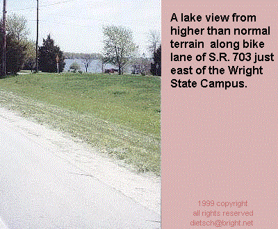
From the Wright State Campus, the S.R. 703 bike lane continues eastward toward St. Marys, Ohio. Prior to the end of the bike lane, our tour leaves the S.R.703 bike lane and turns into the entrance of:
Grand
Lake St.Marys State Park
834 Edgewater Drive.
Marys, OH 45885
(419) 394-3611 Park Office
(419) 394-2774 Camp Office
Once leaving the berm of the S.R. 703 highway, traffic is normally at a much slower pace along the park drive, and residential style street. At the north east corner of the lake, the drive turns into a drive exclusively for the State Park. (S.R.364 parallels this drive just to the east, and actually intersects with feeder Rd.) At the end of the State Park drive at the turn a round, is a path leading to the dam and the canal Lock. At the Canal Lock, Feeder Rd. runs along the canal that once supplied water to the Miami and Erie Canal. The tour winds north and west along Greenville Rd., and west on "West South St." Across from Memorial High School is the parking lot for Memorial Park. Once across the handicap accessible covered bridge, Memorial Park has displays, and markers. Two blocks north of Memorial Park on High St. just east of Front St. is a stone drive which leads down to a stone parking area. At the north end of the parking lot is the Miami and Erie Canal hiking trail.
The "West Bank Rd. of the State Park to
Wright State shore line is about 4 1/2 miles.
Wright State through the State Park to St. Marys Memorial Park is about 11 1/2
miles.
The "Lake and Canal
Tour " is just about 16 miles going the one
direction.
| Outside Linksa | Canal Attractions | St. Marys Area Attractions | Canal Boat Rides |