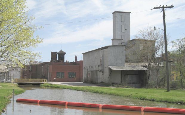
This portion of the Hydraulic is located just to the north of High Street. This canal once supplied water to turn water wheels such for businesses as the Grist Mill pictured above. The lower roof line on the right side of the grain mill was the location of the water wheel which powered a mill stone to grind various grains for area farmers.
The red floats (shown on the right) are a pollution control device for the industry that is currently using water from the Hydraulic.
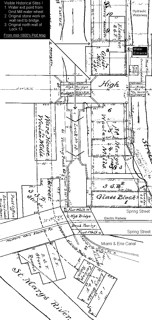
Below is a portion of the 1800s plot map, which includes the street car track.
Viewable Map Printable Maps: Towpath Trail - Delphos - St. Marys