|
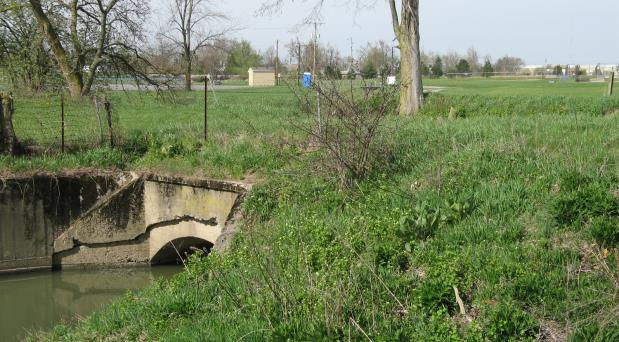
An aqueduct allows a creek to go under the Miami and Erie Canal and towpath at the northeast corner of the Municipal Park just west of Route 66 and north of W. North St. Just a quarter mile to the south at Lock 16, the terrain is elevated to the point that it allows a creek to simply flow into the canal. Had the invention of the train been delayed, Ohio may have had a third major canal that was proposed in central Ohio. This third canal would have run down the northern half of central Ohio along the west side of the Sandusky River from Sandusky Co. to Wyandot Co. at Upper Sandusky. The canal would have then continued south along the Scioto River in Marion Co. and later connected to the Ohio and Erie Canal in southern Franklin Co. near Lockbourne*.* Source: Map of Ohio Canals, prepared by Capt. Hiram M. Chittenden, Corps of Engineers, U.S.A
|
 |