| The Miami and Erie Canal currently ends at the Loramie Creek Aqueduct located beside residential properties on the north outskirts of Ft. Loramie, Ohio. For hikers a the 2/3 mile round trip from Canal Road 1, the towpath trail (west side of the canal), offers the best vantage points of the aqueduct. The alternative trail on the east side of the canal is posted with a rail. The east side trail offers access to hiking the trail along the feeder canal. The Feeder Canal no longer supplies water from Lake Loramie. |
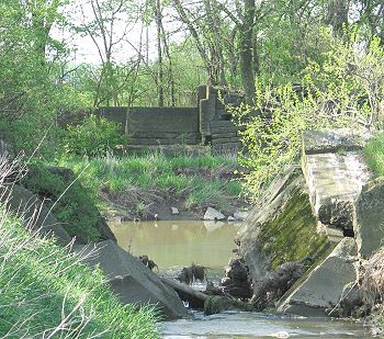 |
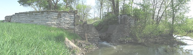
The base of Loramie Creek Aqueduct is the southern end of this portion of the Miami and Erie Canal. Land south of Loramie Creek is privately owned.
Below is a farmhouse of the canal era on the north side of Loramie Creek just west of the utility substation driveway beside S.R. 66.

Viewable Map Printable Maps: Towpath Trail - Delphos - St. Marys